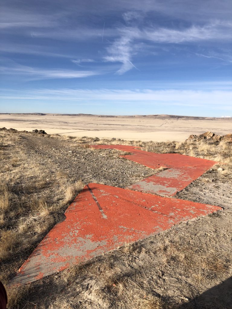
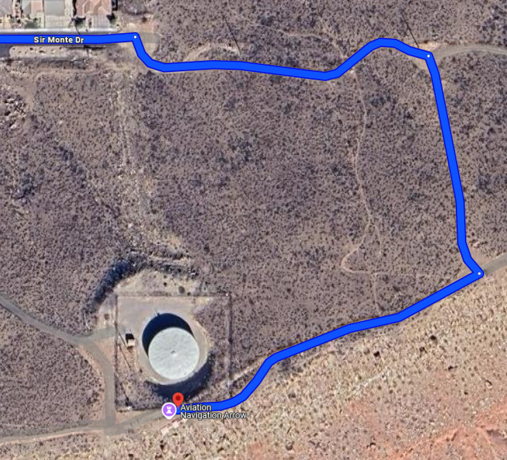
Navigation Arrows
There are 11 navigation arrows located throughout Utah. 8 of these are publicly accessible, while 3 are situated on private property. Please be respectful of private property and do not trespass to access these 3 sites. They are intended as flyover-only opportunities and are not required to qualify for the award.
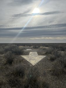
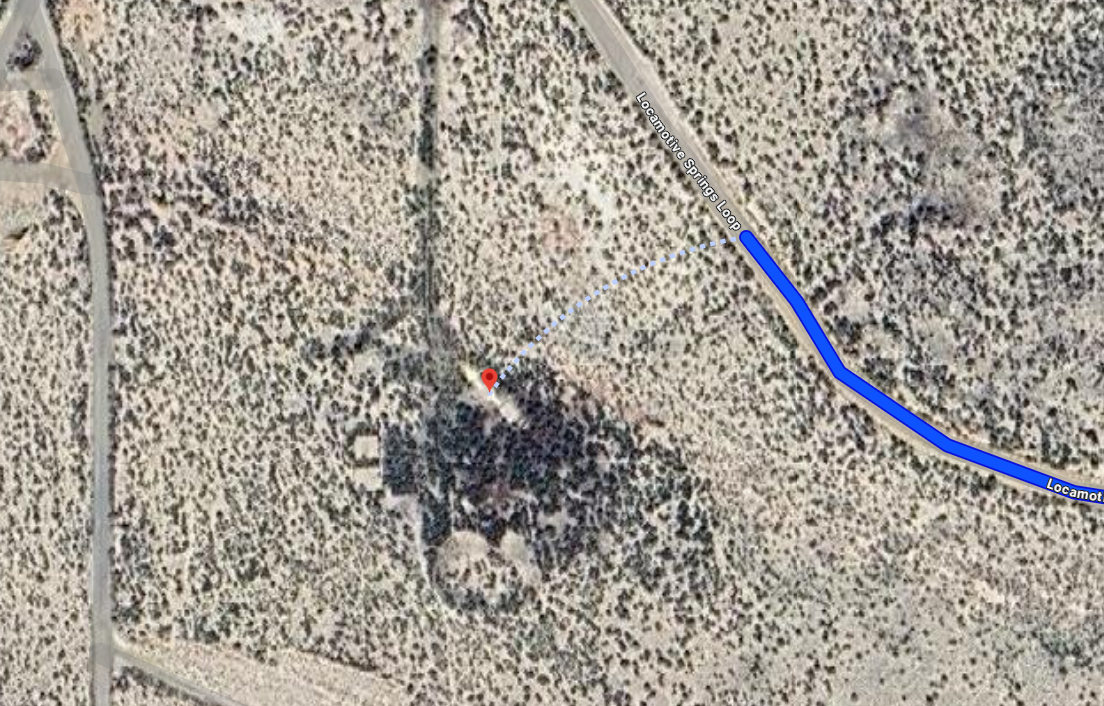
Locomotive Springs
41.708252, -112.919707
Box Elder County
- High clearance vehicle required.
- Short walk on flat ground from the road.
- This arrow is located on Locomotive Springs Loop.
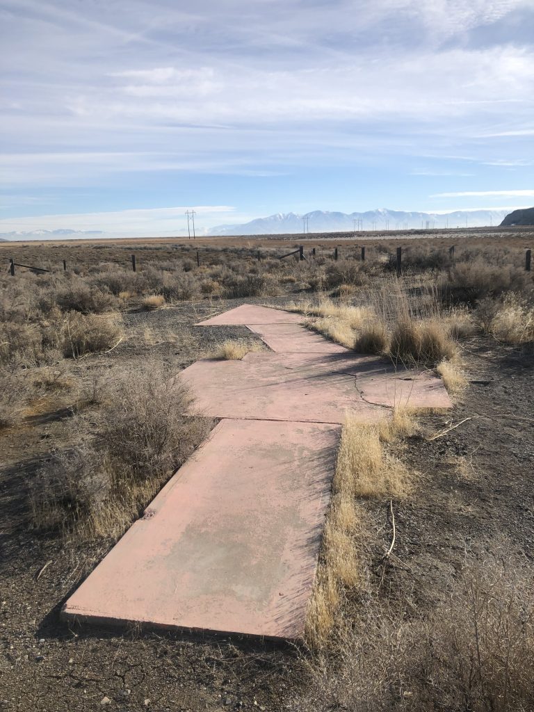
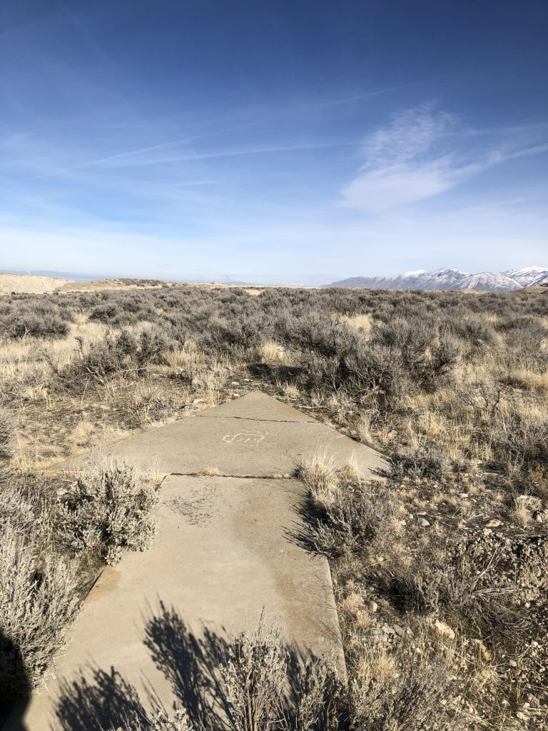
Low Airway
40.826505, -112.905742
Tooele County
- High clearance vehicle required.
- Hiking most likely required.
There’s a road that leads directly to this arrow-and you can even drive over it! However, it becomes quite steep, so be prepared and consider planning to hike part of the way.
Once you exit the the interstate, take two right turns. The trail leading to the arrow is a small unmarked dirt road.
Poverty Point
40.750015, -112.648235
Tooele County
- Easily accessible.
- Park just outside the fenced area near the arrow.
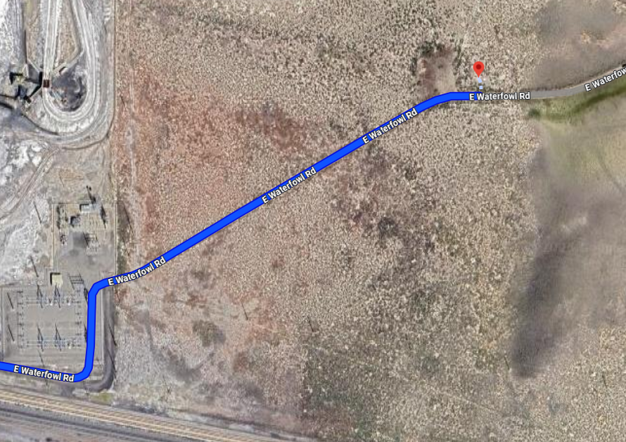
To access the arrow, exit the interstate as if you’re heading to the Cargill Salt Plant. Instead of continuing to the plant, take a right and go through the gate in the fence. Follow that road, and you’ll come to a small wooden fence surrounding the arrow.
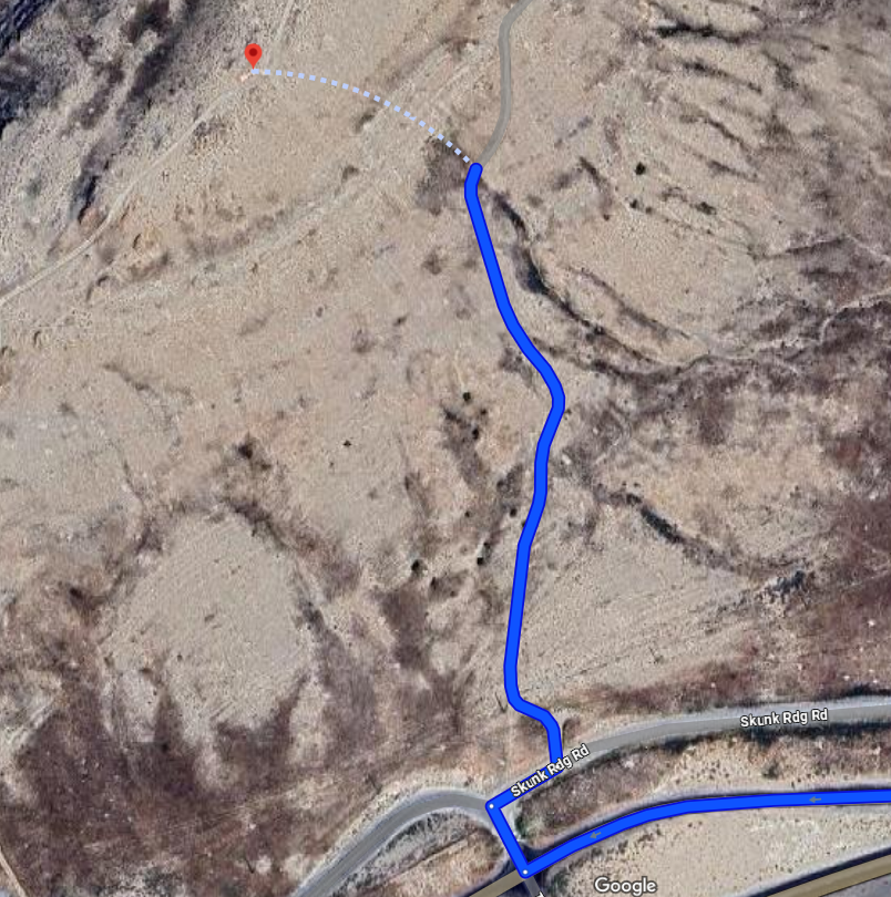
Stockton
40.458392, -112.363756
Tooele County
- Easily accessible road; no high clearance vehicle needed.
- Hiking required to reach arrow.
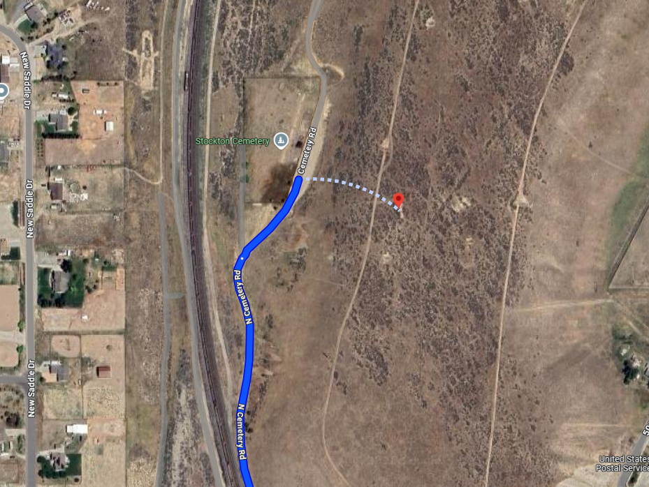
The road access for this arrow will lead you to the base of the hill where it is located. Please note that there is no designated parking at the base. Be courteous and pull off the road enough to allow other vehicles to pass.
A hike is required from this point. The terrain is semi-steep but manageable. The arrow is located just over the ridge.
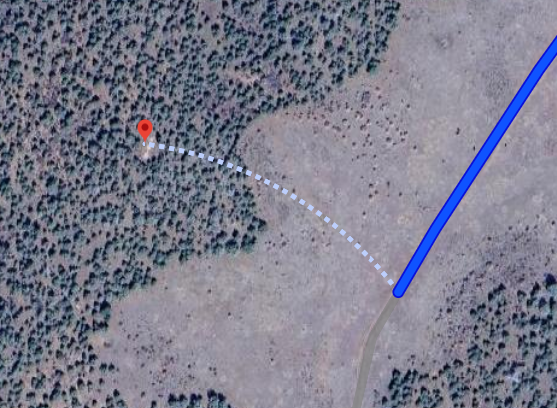
Black Ridge
37.395882, -113.257308
Washington County
- Road is paved most of the way; last three miles are dirt.
- Walking required for the final portion.
- Arrow is located in the trees; GPS recommend for exact coordinates.
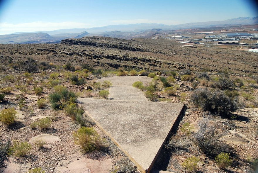
Bloomington Overlook
37.065031, -113.595362
Washington County
- Paved road to base of hill.
- Dirt road to the water tower. high clearance vehicle recommended; or short manageable hike
- Beautiful views
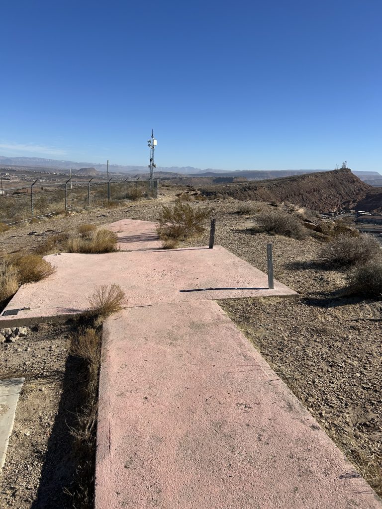
This arrow is situated just behind a residential neighborhood. If you are hiking, please ensure you pull off of the paved road in the small area, that provides limited space for parking. We kindly ask that you be considerate of local residents and use only the designated pull off areas.
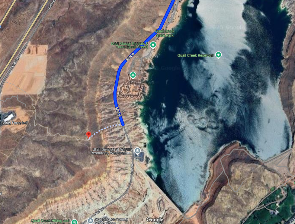
Quail Creek
37.180577, -113.400438
Washington County
- Dirt road to the bottom of the ridge.
- Hiking required.
- Semi-steep hike, with no shade.
Shinob Kibe
37.117443. -113.487642
Washington County
- Hiking is required. 1.4 miles. 1+ hours estimated hike time.
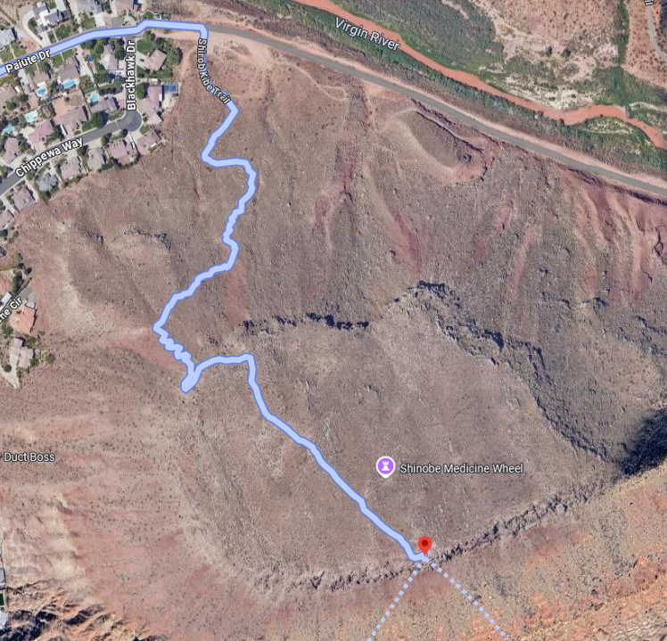
This arrow is located on top of a plateau and is best accessed via the Shinob Kibe hiking trail. The trailhead is situated within a residential neighborhood, so please be respectful of local residence. While there is no designated parking lot at the trailhead, a large dirt area nearby is available for parking.
Remember to be prepared for hiking conditions typical of Southern Utah. The trail offers very limited shade, if any, depending on time of day. Plan accordingly.